Log in
All resources
Create a design
59 Free Artworks of Map Native
maps of native american tribal territories
maps in the rijksmuseum amsterdam
prints by jan luyken in the rijksmuseum amsterdam
maps by jan luyken
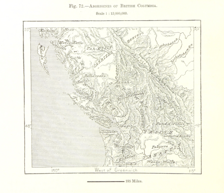
maps from the earth and its inhabitants, vol. xvii
wanderings, south and east (1882)
jan luyken
powhatan
university of texas at arlington
de nieuwe groote lichtende zee-fakkel (rijksmuseum)
medieval
maps
maps of native american tribal territories
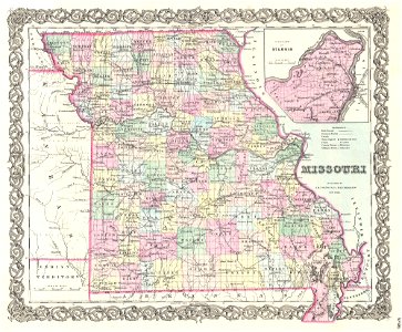
old maps of missouri
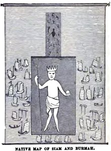
myanmar in art
wesleyan
1805 maps of the united states
maps by john cary
charts and maps of the royal museums greenwich
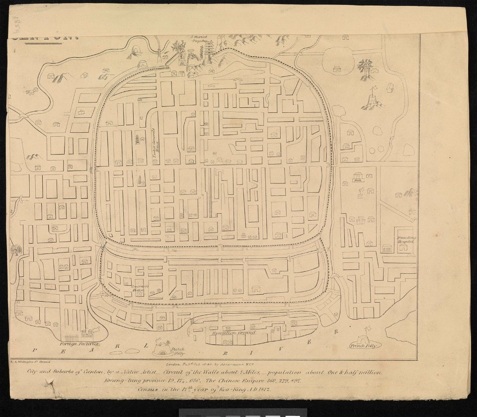
old maps of guangzhou
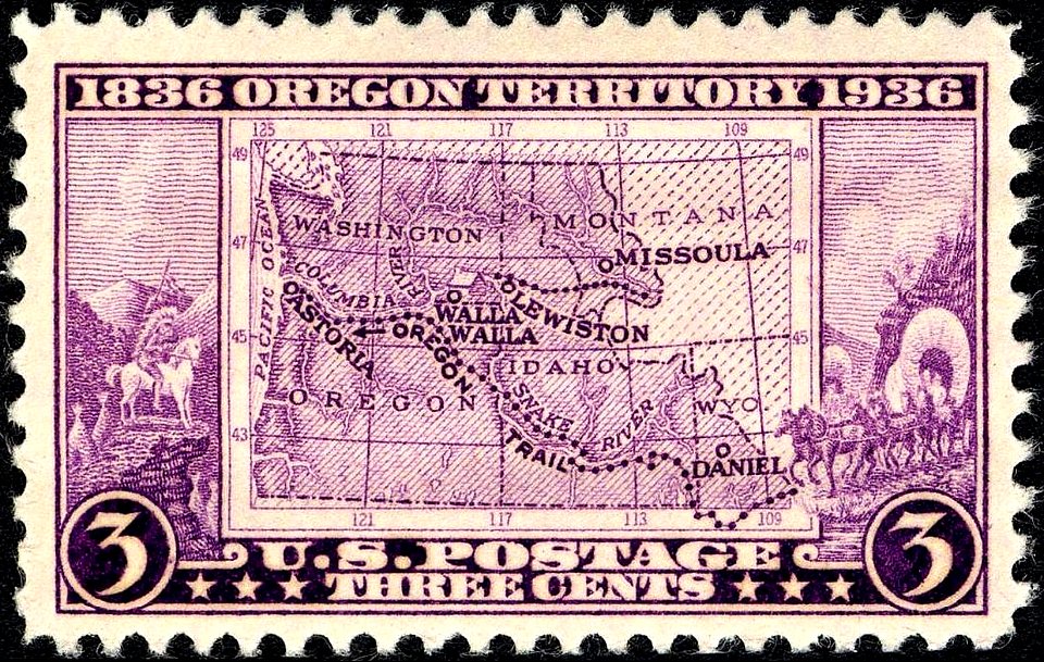
oregon territory
purple stamp
17th-century oil paintings of standing women at full length
17th-century paintings of people with dogs
old maps of the united states
old maps of virginia
maps of aboriginal australia
old maps of new south wales
maps by jodocus hondius
old maps of virginia
1747 maps of north carolina
maps by emanuel bowen
everett d. graff collection of western americana
cherokee nation
illustrated title pages
1645 books
maps of the war of the spanish succession
apalachee
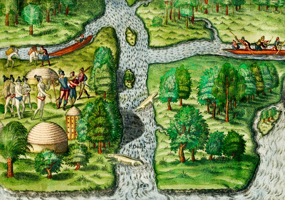
the generall historie of virginia (john smith)
1624 engravings
maps from the earth and its inhabitants, vol. xi
africa in the 1880s
sheets of stamps of russia, 1997
moscow on stamps
postcards of alaska
map postcards
old maps of the chesapeake bay
sir walter raleigh
maps from the earth and its inhabitants, vol. xvii
topographic maps of new york (state)
wanderings, south and east (1882)
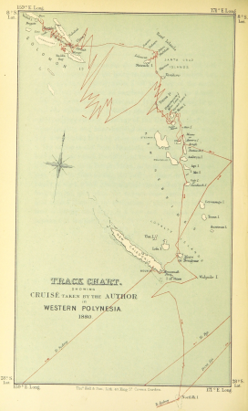
old maps of polynesia
asia noviter delineata
native indonesians
maps from the earth and its inhabitants, vol. xi
algeria in the 1800s
maps from the earth and its inhabitants, vol. xv
maps of native american tribal territories
native american history of virginia
17th-century maps of virginia
18th-century maps of the indian ocean
18th-century maps of southeast asia
the generall historie of virginia (john smith)
maps of jamestown, virginia
17th-century maps of trinidad and tobago
animals on maps
wanderings, south and east (1882)
1882 maps of the world
atlas sive cosmographicae (gerardus mercator, 1596)
hendrik hondius the younger
maps from the earth and its inhabitants, vol. xvii
anton francesco lucini
1744 maps of quebec
saguenay river
maps by gouverneur k. warren
maps by edwin freyhold
maps from the earth and its inhabitants, vol. xvii
maps of native american tribal territories
flora from the british library mechanical curator collection
wanderings, south and east (1882)
description de l'universe
alain manesson mallet
1690s maps of the caribbean
1690s maps of the americas
wanderings, south and east (1882)
views of rio de janeiro
maps from the earth and its inhabitants, vol. xvii
maps of native american tribal territories
manners, customs, and condition of the north american indians (1841)
realism
maps from the earth and its inhabitants, vol. xv
first nations people of british columbia
carte du mexique et de la floride by guillaume delisle (1703)
french-language maps of mexico
notes on the state of virginia
augustus kollner
17th-century people of africa
africa in the 1680s
podręcznik geografii ojczystej (1894)
romanticism
maps of roanoke island
theodor de bry
1805 maps of the united states
maps by john cary
maps by thomas nast
1872 maps of texas
mapa general de españa (1802)
a briefe and true report of the new found land of virginia
theodor de bry
extracts from carta hydrographica y chorographica de las yslas filipinas
baroque painting
prints by caspar luyken in the rijksmuseum amsterdam
maps in the rijksmuseum amsterdam
maps in the rijksmuseum amsterdam
maps by frederick de wit
etchings of birds in the rijksmuseum amsterdam
maps in the rijksmuseum amsterdam
across the sub-arctics of canada (1898)
arthur heming
de nieuwe groote lichtende zee-fakkel (rijksmuseum)
maps in the rijksmuseum amsterdam
mappe-monde geo-hydrographique (sanson and jaillot, 1674)
de nieuwe groote lichtende zee-fakkel (rijksmuseum)
maps in the rijksmuseum amsterdam
de nieuwe groote lichtende zee-fakkel (rijksmuseum)
maps in the rijksmuseum amsterdam
1 - 59 of 59
/ 1